Dear friends and family,
Leg two begins! Now I start my rambles up into the Pacific Northwest, starting from Sacramento, CA back on 11 June.
“But why Sacramento?” I hear you ask, “why, Evan, why? Why meander to the sampy, inundated, golden state sloughs when you could ramble on up the coast?”
Well, in short order, the answer is time. Despite having 5 months to travel the country (maybe 4 now? Updates TBD), I do have time constraints on this trip. One of these constraints was to be home in Michigan for the 50th wedding anniversary of my Aunt Sue and Uncle Bill, and Sacramento was the most convenient spot to fly home briefly from the 9th to the 11th to attend the party. I was glad to be home, and it was really great to see my family again! Aunt Sue and Uncle Bill, congratulations again on your half a century of marriage! I enjoyed hanging out with you guys during the party and seeing the photos of your guys’ wild hair back before run was around 😉 it was also really lovely to reconnect with my cousins BJ and Nathan and Madelin, and Aunt Jeanie and Aunt Betty and Great Aunt Nora! Aunt Betty, I promise I’ll come visit on the return leg of the trip in August or September!
And Great Aunt Nora, thank you so much for telling me about the cooking and the living and the growing up you did back home in Ivanhoe! I really appreciated the story about electricity coming out of the wind-up phones during thunderstorms! One of my favorite rap artists is a group named OutKast, and one of their songs is named “Da Art of Storytellin’ Part 2”, in which the song begins with a monologue from an old grandma to “Cut that loud mess off, and get off the phone!” during a thunderstorm. I never understood what the point of this monologue was, but I finally got it when you explained that lightning used to jump out of the old phones and into the house when you weren’t careful!
Also, special shoutout to my Dad for, somehow, managing to recover the lever-action rifle from Charlie Compton that Uncle Bill had sold to Harold Compton (Charlie’s father) 50 years prior to pay for Aunt Sue’s Medical School. I could tell it meant a lot, a lot a lot, for you to gift that to Uncle Bill and Aunt Sue!
(Dear non-Lee readers: sorry for the Prairie Home Companion-styled lore, but my people are the yammering and plodding type Garrison Keilor always gave a send-off to at the end of his shows. Ivanhoe and Lake Stay, Minnesota, my grandmother’s and Great Aunt Nora’s home, is a carbon copy of Lake Woebegon)
And to all my readers from home; I’m sorry I don’t have any pictures from this reunion party! Somehow I got so caught up with my family that I forgot to take any pictures of the times! My bad!
Anyways, one interesting tidbit I did manage to photograph on the way back home: Lake Tulare!
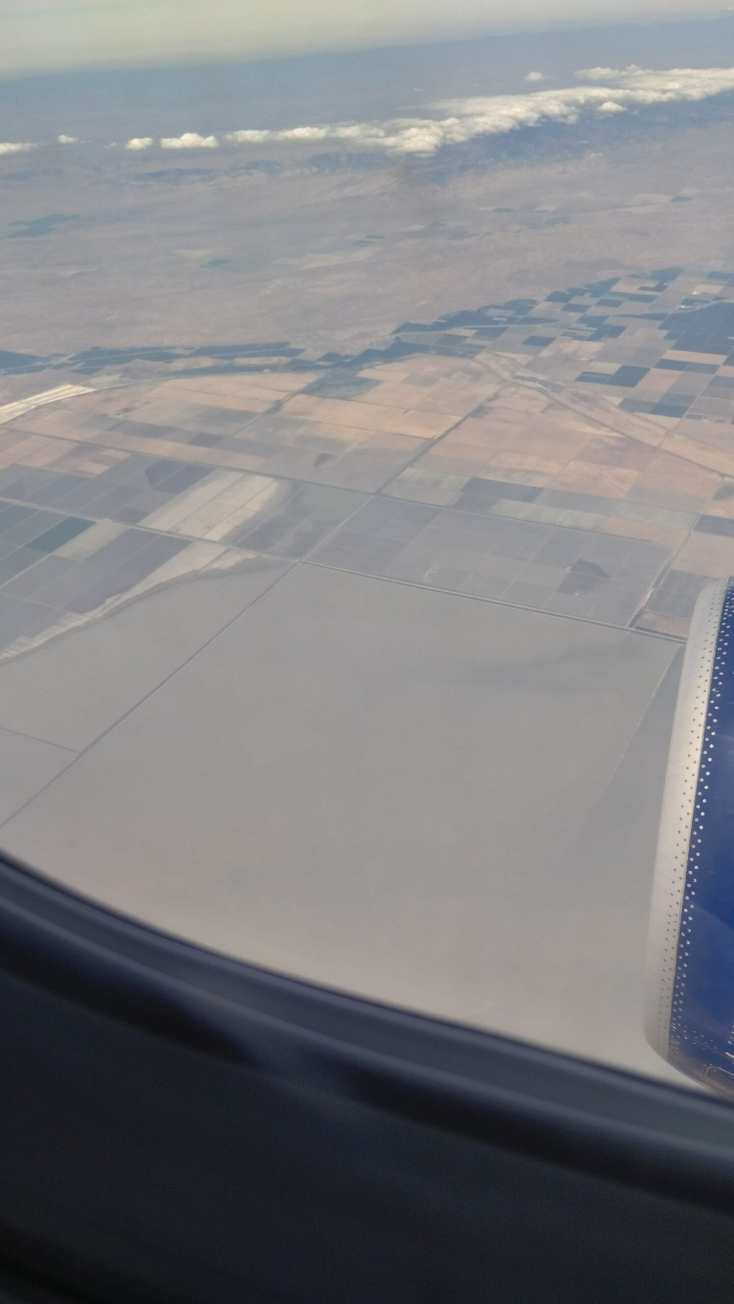
Pre-colonization, the south end of California’s Great Valley, between modern-day I-5 and CA-99 west of the town of Tulare, was covered by a freshwater lake named Tulare Lake. At 650 square miles, Tulare Lake was the largest lake in the contiguous US west of the Mississippi, until drainage efforts on the feedwater Kern, Tule, and other Southern California Rivers (as well as a determined genocide of the Yokuts living in the area) dried up the lake entirely by the 1930s. But the rifle and the plow have not sequestered mother nature, and in times of extreme flooding like the 2023 snowmelt brought, Tulare Lake returns:
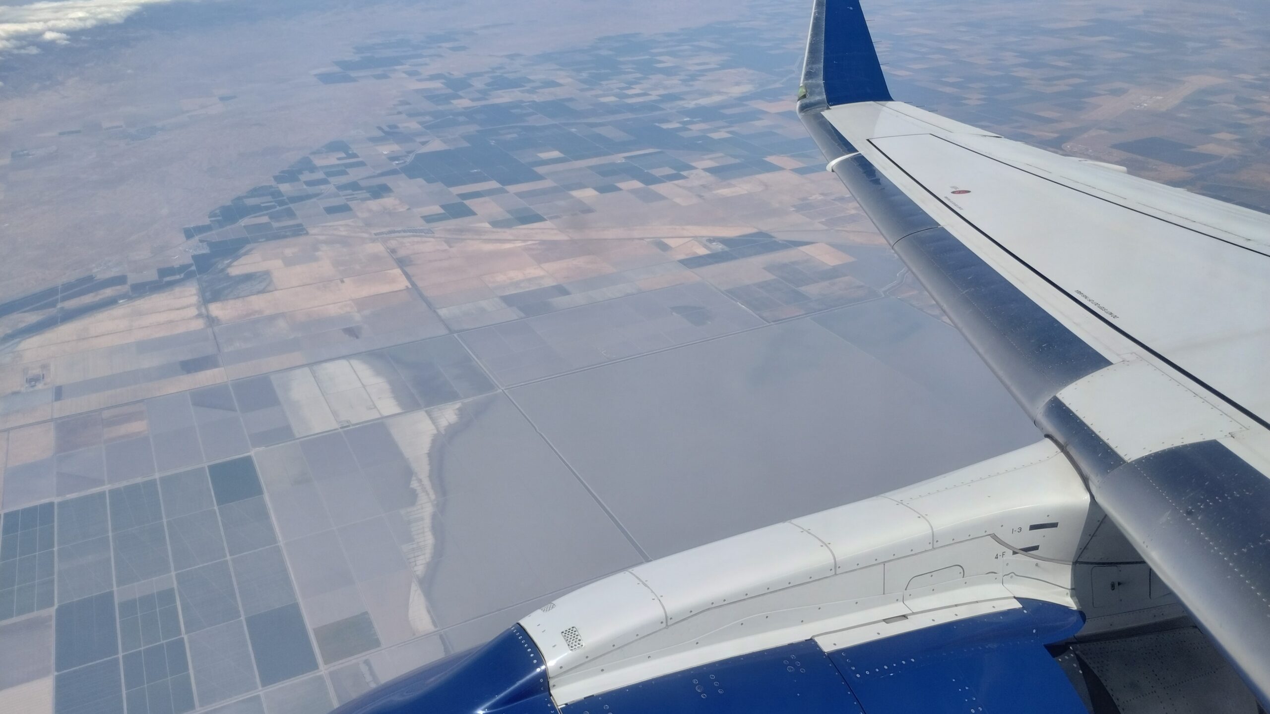
Tulare Lake now stands at about 180 square miles, and is expected to last for around two years. My return flight to Sacramento didn’t cross paths with the lake, but what I wouldn’t give to have seen some of the other sides of the lake on the way back west!
Anyways, the rest of this update will be relatively short since it covers only 3-4 days of actual travel time between Sacramento, CA and Portland, OR.
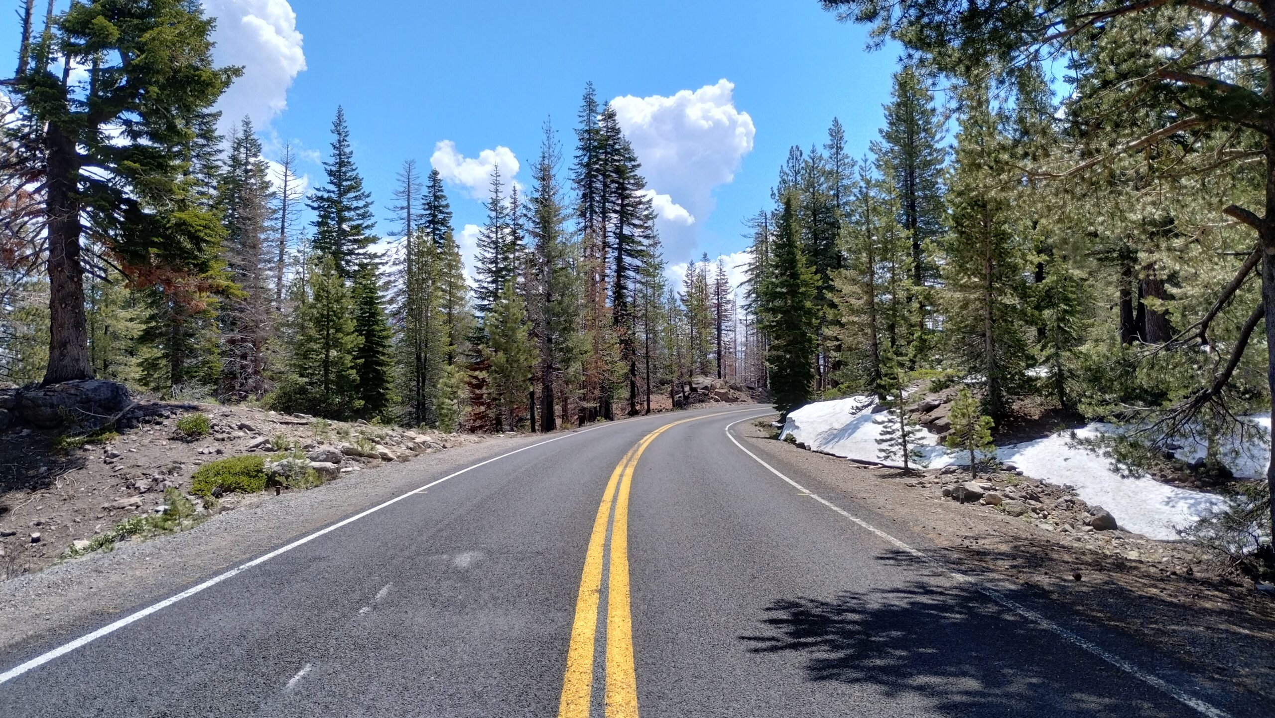
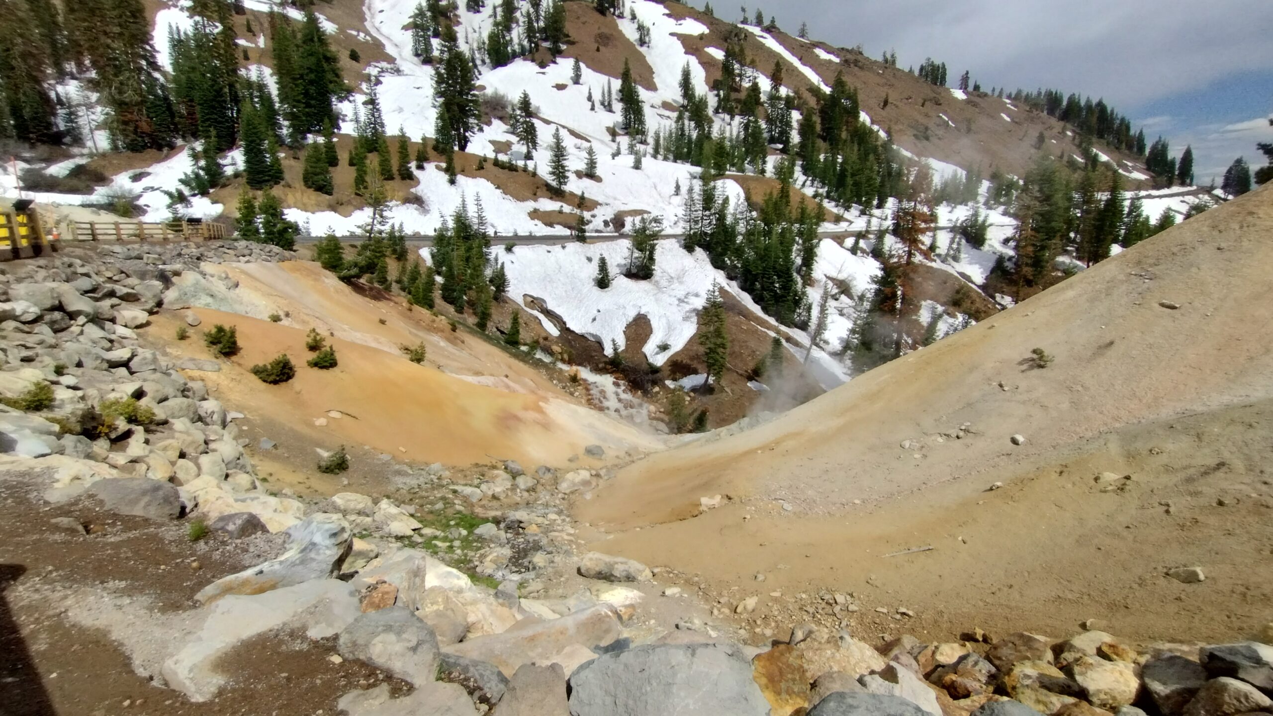
After leaving Sacramento, I beat feet for Northern California and Lassen Volcanic National Park. Lassen is one of the lesser-known National Parks, but contains several dormant Volcanoes and geothermal activity to rival Yellowstone. The trouble is that, mike much of the west coast mountains, it’s still under 8 feet of snow.
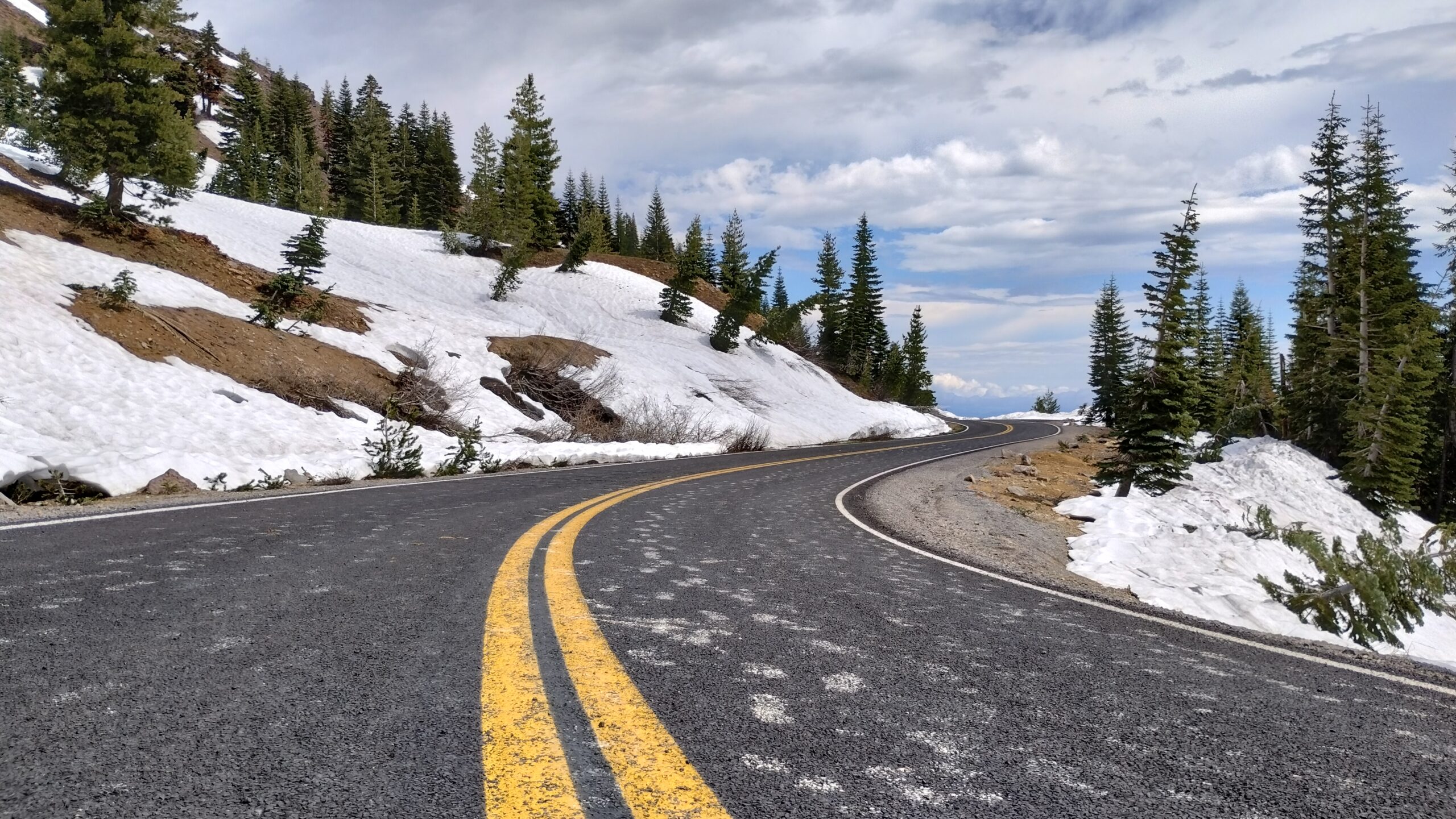
The roads into and out of Lassen are all closed due to heavy snowfall, and only a few miles of road are open to walkers and cyclists beyond the last available parking lots. This did, however, give the nice opportunity for a roadwalk absent of any danger:
Well, almost any danger, anyways.
While the most famous sites in the park are currently inaccessible due to the road closure, one less famous area is: the “devastated area”.
This burned-over area is the gravesite of the 2021 Dixie Fire. I know it may seem like chump change now to my friends currently coughing on Canadian wildfire smoke on the east coast, but the 2021 Dixie Fire was responsible for the hazy skies and dusty windowsills we all experienced in the summer of 2021, and have to deal with even more so today.
All of the trees in this area of the park are scorched to the core, and how some of them manage to stay standing will always be a mystery to me:
There is little else alive in the devastated areas two years on, besides moss and scrubbrush:
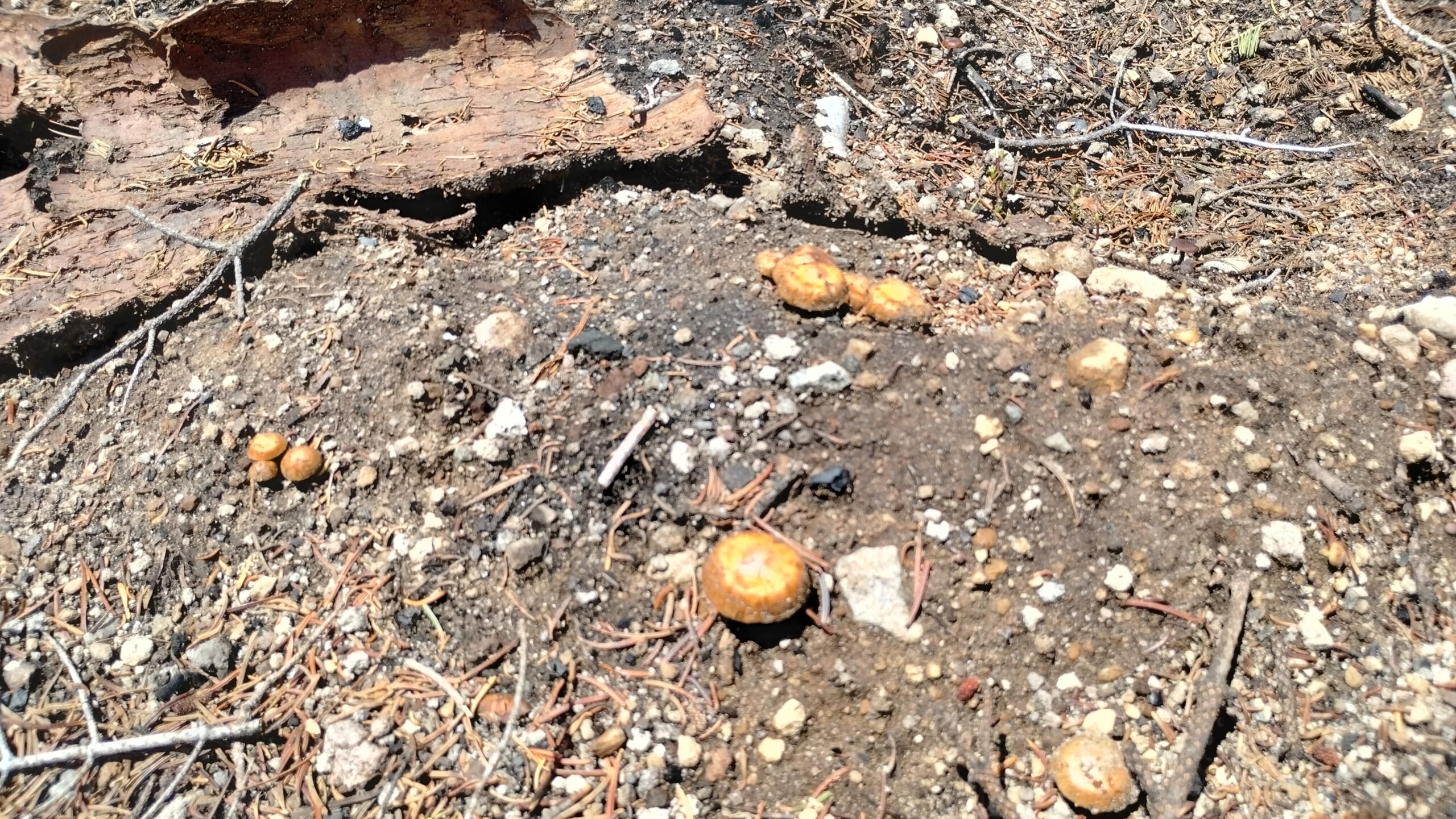
Some mushrooms are poking up through the dirt too.
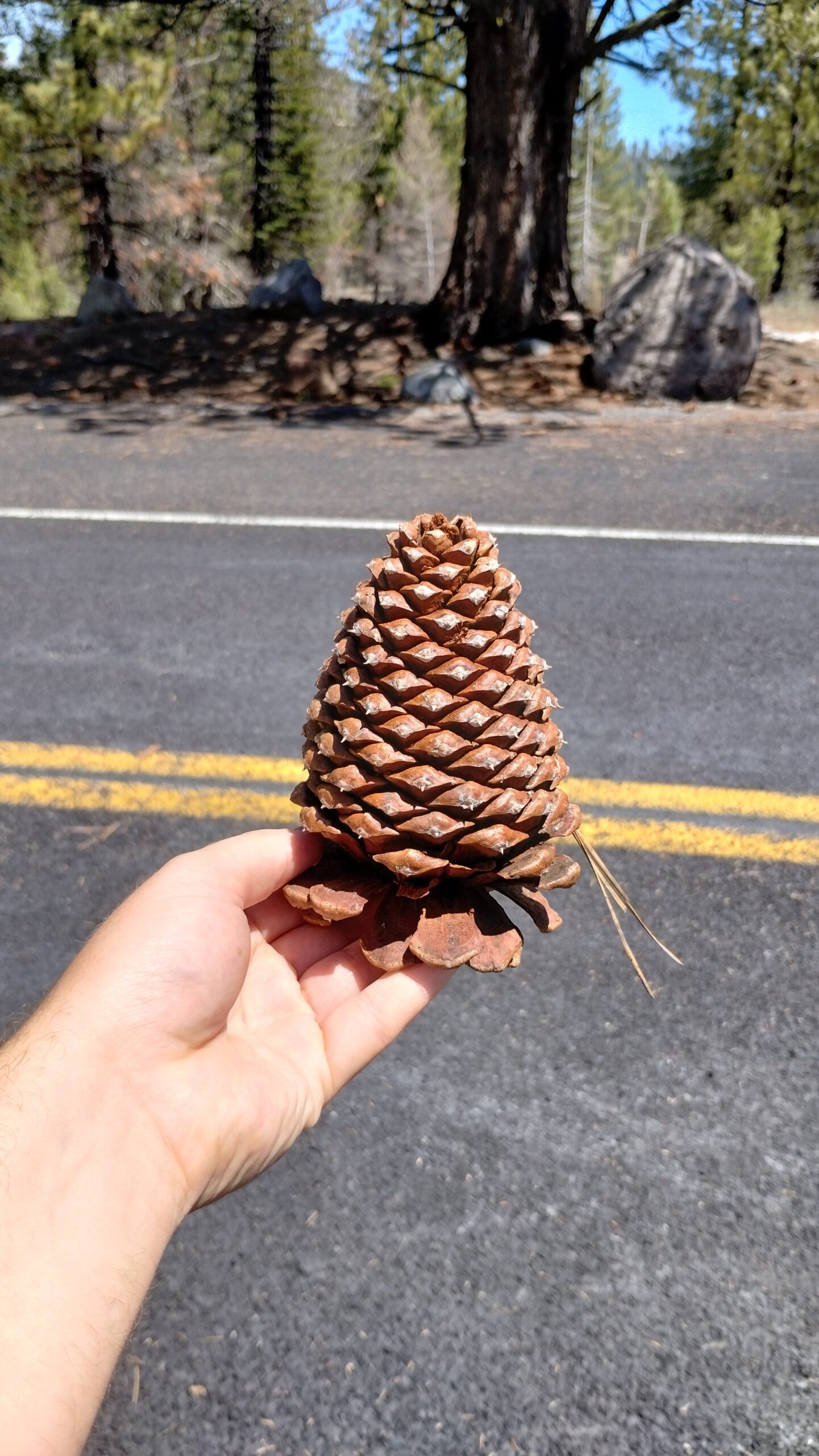
Pinecones promise that the forests will return someday! (Also these are some of the biggest and sharpest pinecones I’ve ever seen).
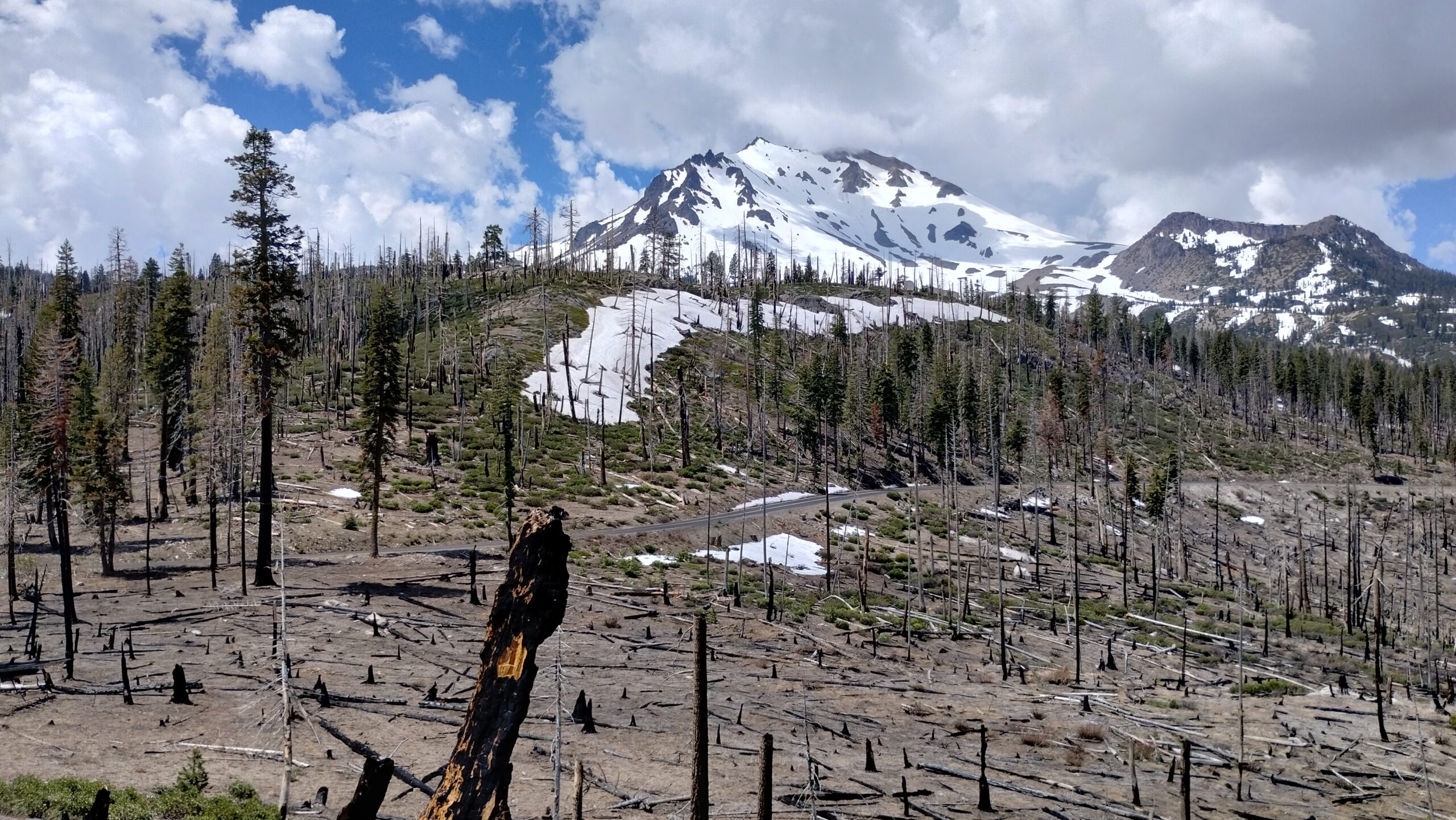
The devastation doesn’t prevent seeing some great views of Lassen Peak, though.
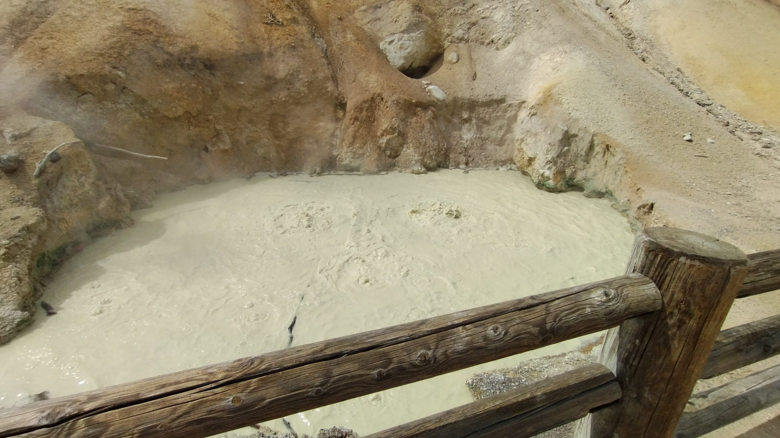
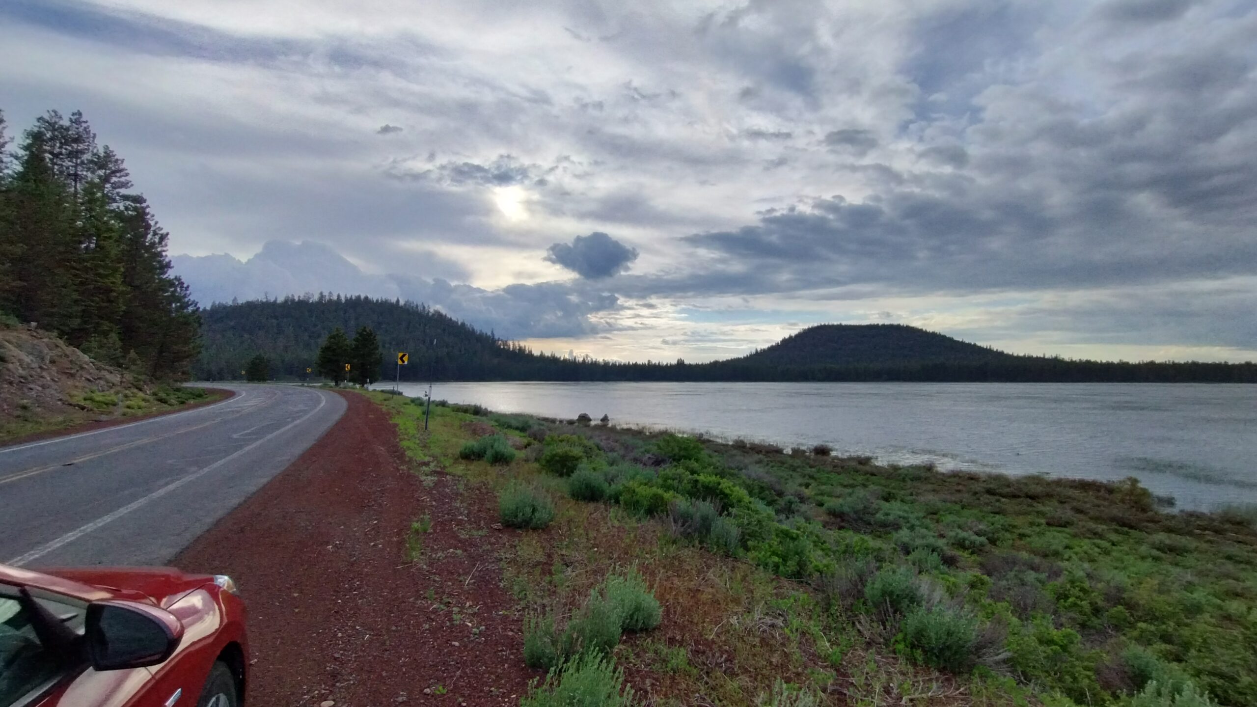
On the south side of the park, even less is open, and you can’t reach the famous sulfur springs at Bumpass Hell. There’s only two other springs that can be reached from the road, which are still cool in their own right:
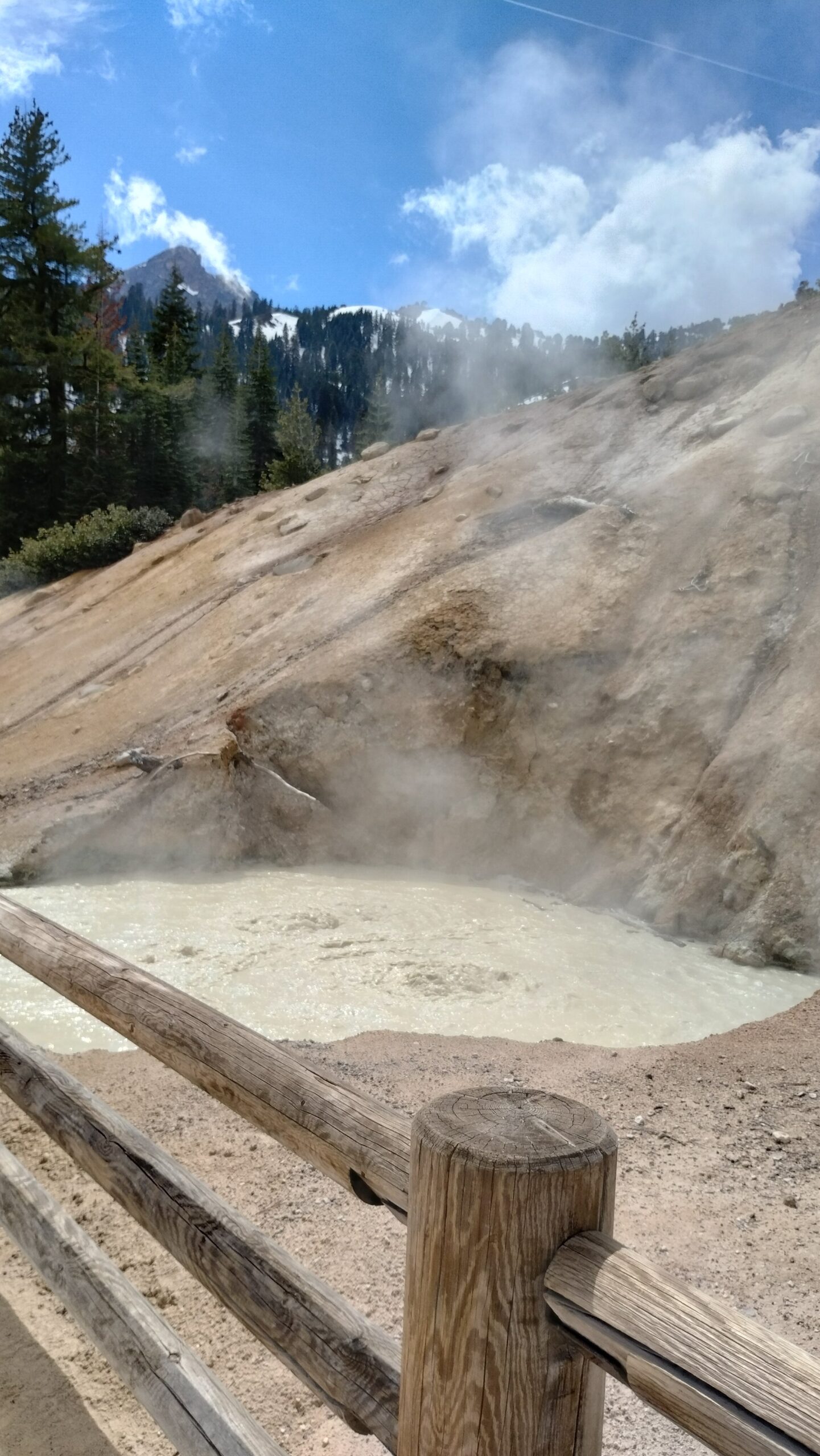
Visiting Lassen reminded me that there are some feelings and experiences my blog is never going to be able to convey; in this case, smell. The eye-watering, hair-shriveling, tongue-roiling stench of sulfur is hits you like a sea wave as you approach the sulfur springs: unexpectedly, all at once, and rushing far up your nose into your sinuses.
I’ve been dying to see some hot springs on this trip, but now I’m dying smelling them!
But there are other, lovelier smells in Northern California. There is one smell that I have sniffed throughout the PNW, most strongly in Northern California after it rains, but which all the park rangers, forest sevice workers, and NorCal locals haven’t been able to identify (as in, they can smell it, but they don’t know where it comes from). The smell is strong black pepper, with a tiny bit of funk in it, like there is some mustard powder or white vinegar mixed in. I’ve noticed it most in stands of ponderosa pine after it rains, but the smell isn’t from the trees themselves or the lichens and moss growing on them. I even met a local who had lived in the area for 30 years, and still didn’t know what caused that savory smell. Ah well ¯\_(ツ)_/¯
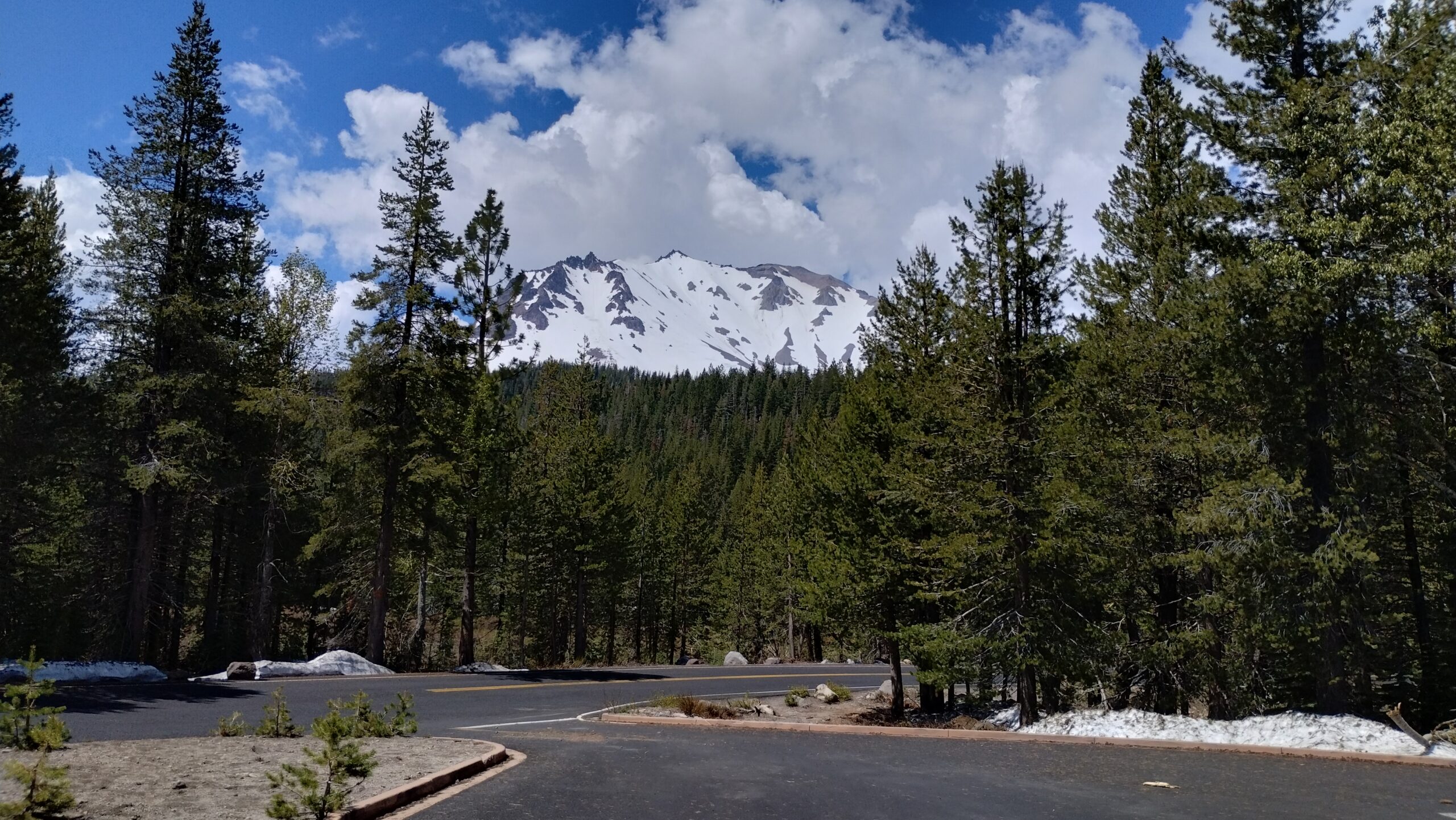
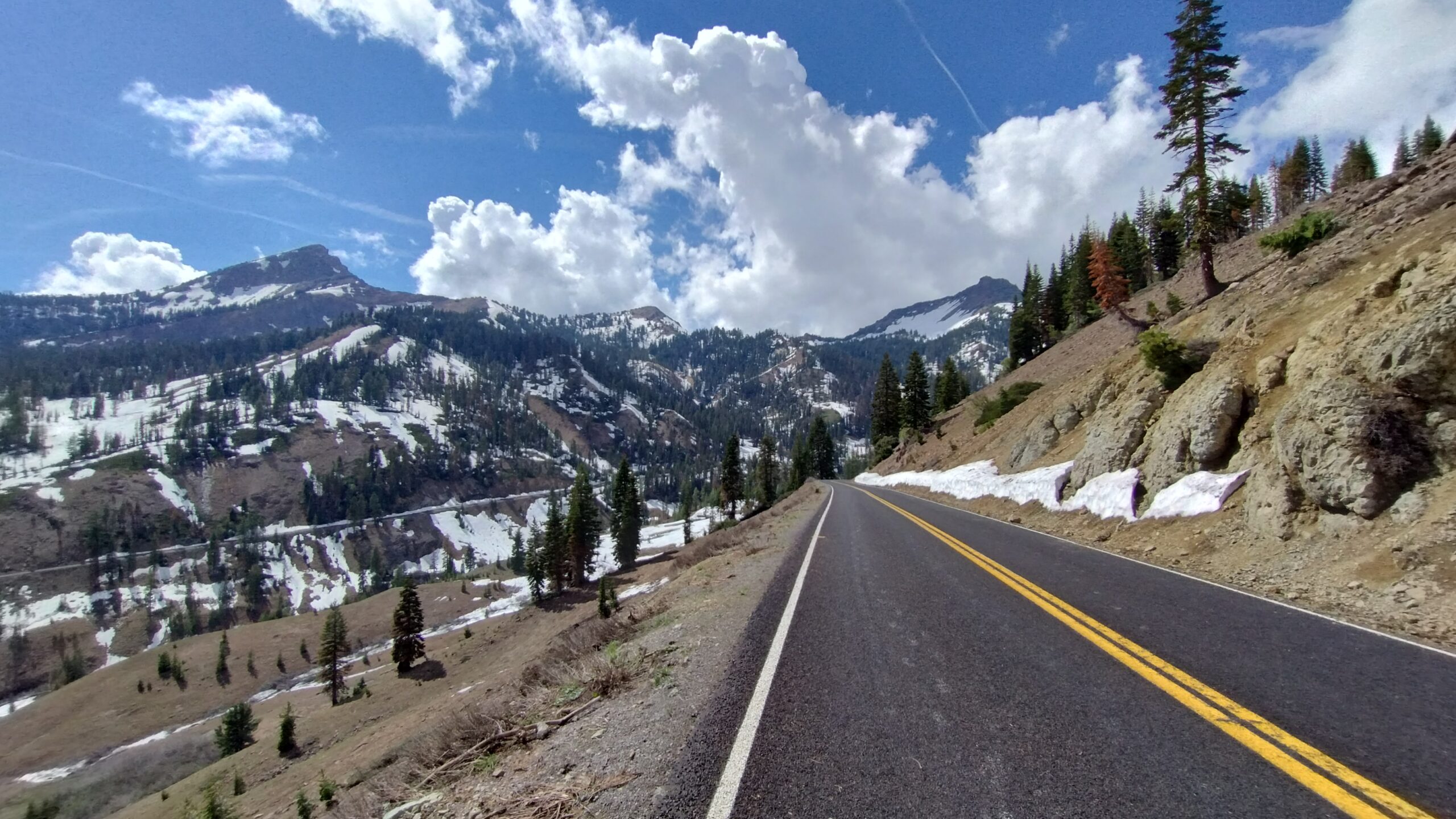
After a few days, I rounded Mt. Shasta and made my way north towards Bend, Oregon. Mt. Shasta is one of the first mountains you see in the Cascades going north out of California (I think Lassen might be the very first). Unlike the Appalachians, the Sangre De Cristo, or the Sierras, the Cascades aren’t a formidable wall of mountains; they’re tall, sure, but they’re more scattershot on the land, with wide and slow valleys forming between them. The tallest peaks rise far above the rest of the neighboring mountains and are still capped with snow.
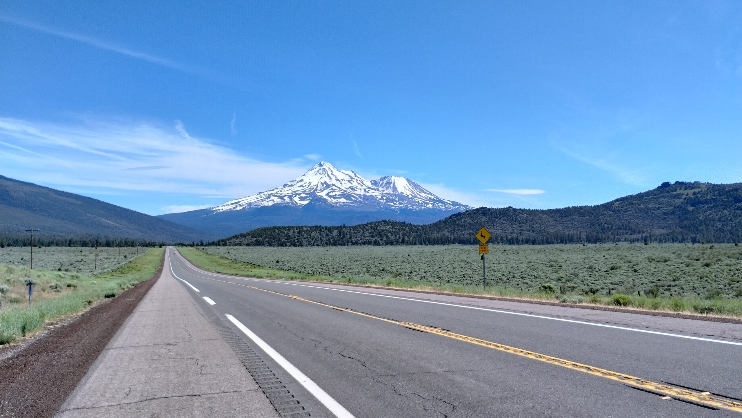
Mt. Shasta.
Past Mount Shasta is the Oregon state line, and just over the border is the town of Klamath Falls. I didn’t have any plans to stop in Klamath Falls, but what I saw in the namesake river gave me pause:
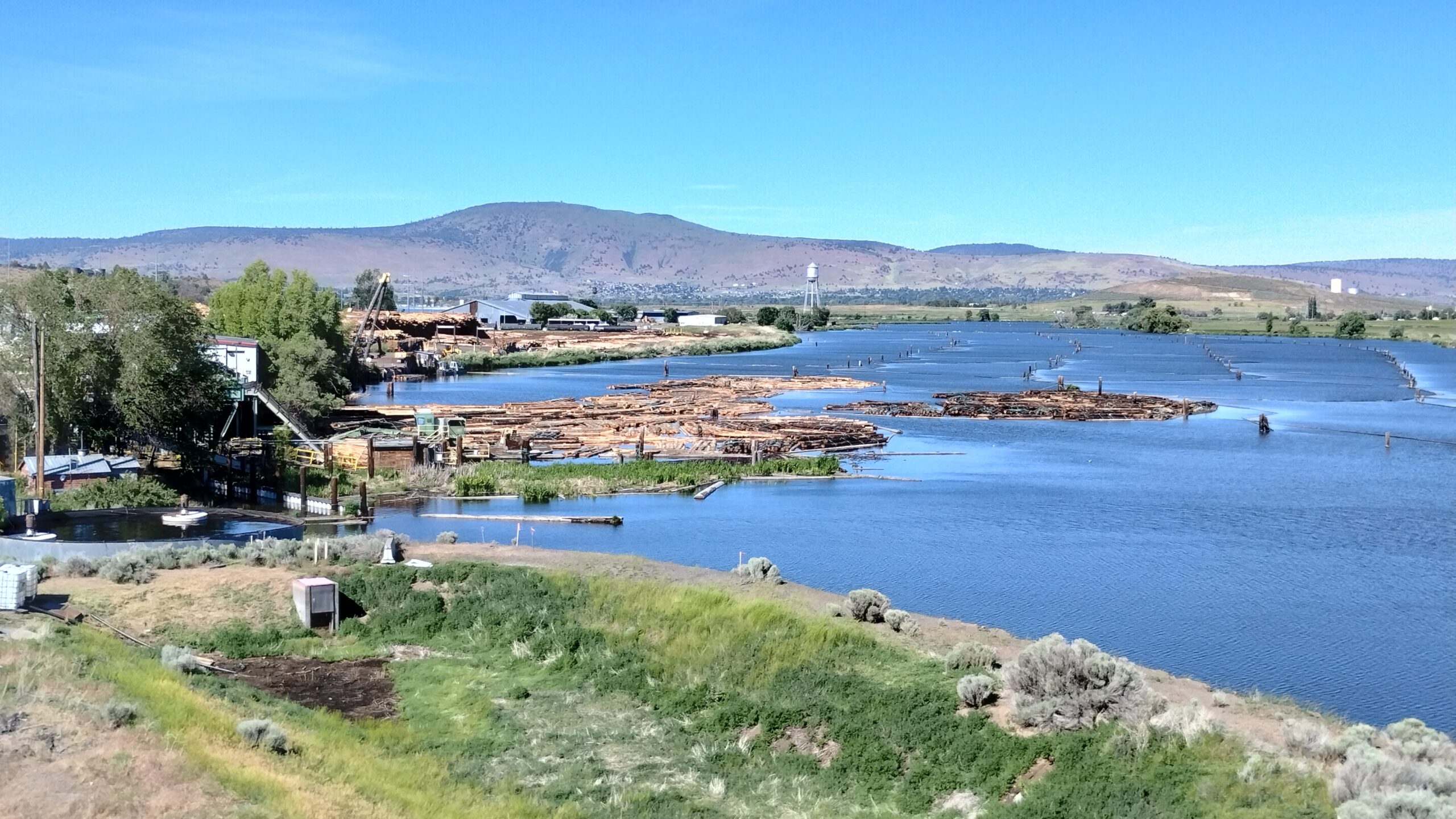
They’re still rafting timber in the Klamath River! Look at all the log booms out there, waiting to be loaded into the mill for processing! Timber rafting is a process that does out in Michigan in the 1880s, but here in Oregon they’re still sendinf acres of timber down the swollen spring rivers to the sawmills.
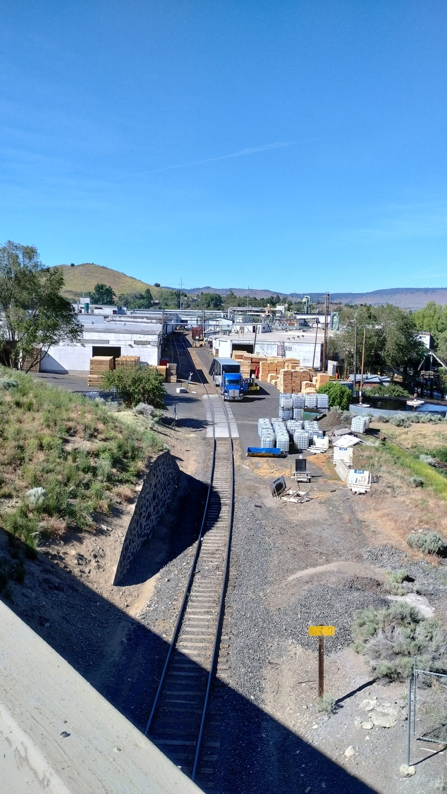
What a crazy little piece of history to see, still alive, in Klamath Falls!
I stayed overnight in Bend, Oregon, before finally moving on up towards Portland to meet some very special visitors. The last town I visited before the city was Hood River, where I was pleased to see a huge flotilla of kiteboarders and windsurfers working the river:
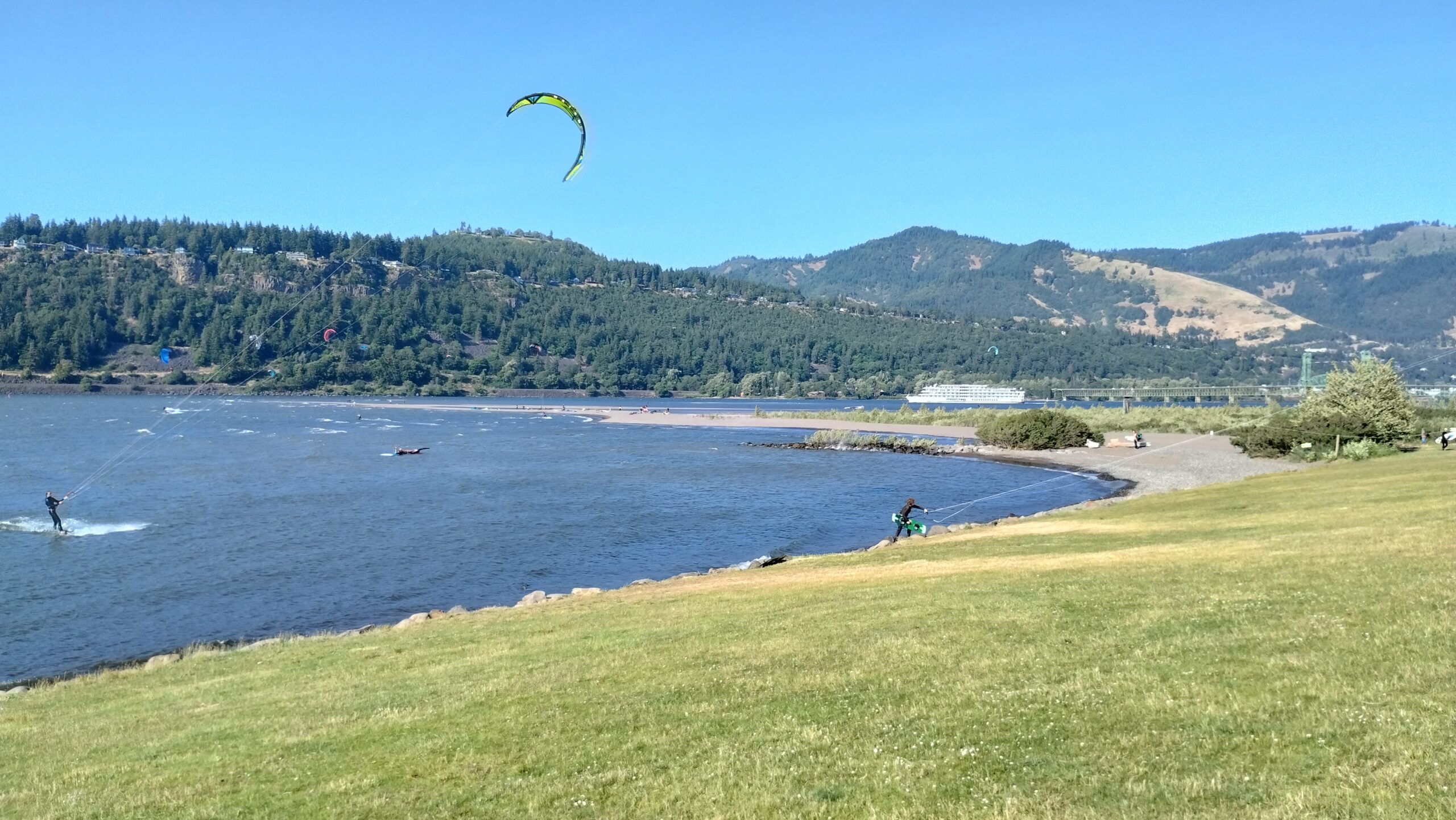
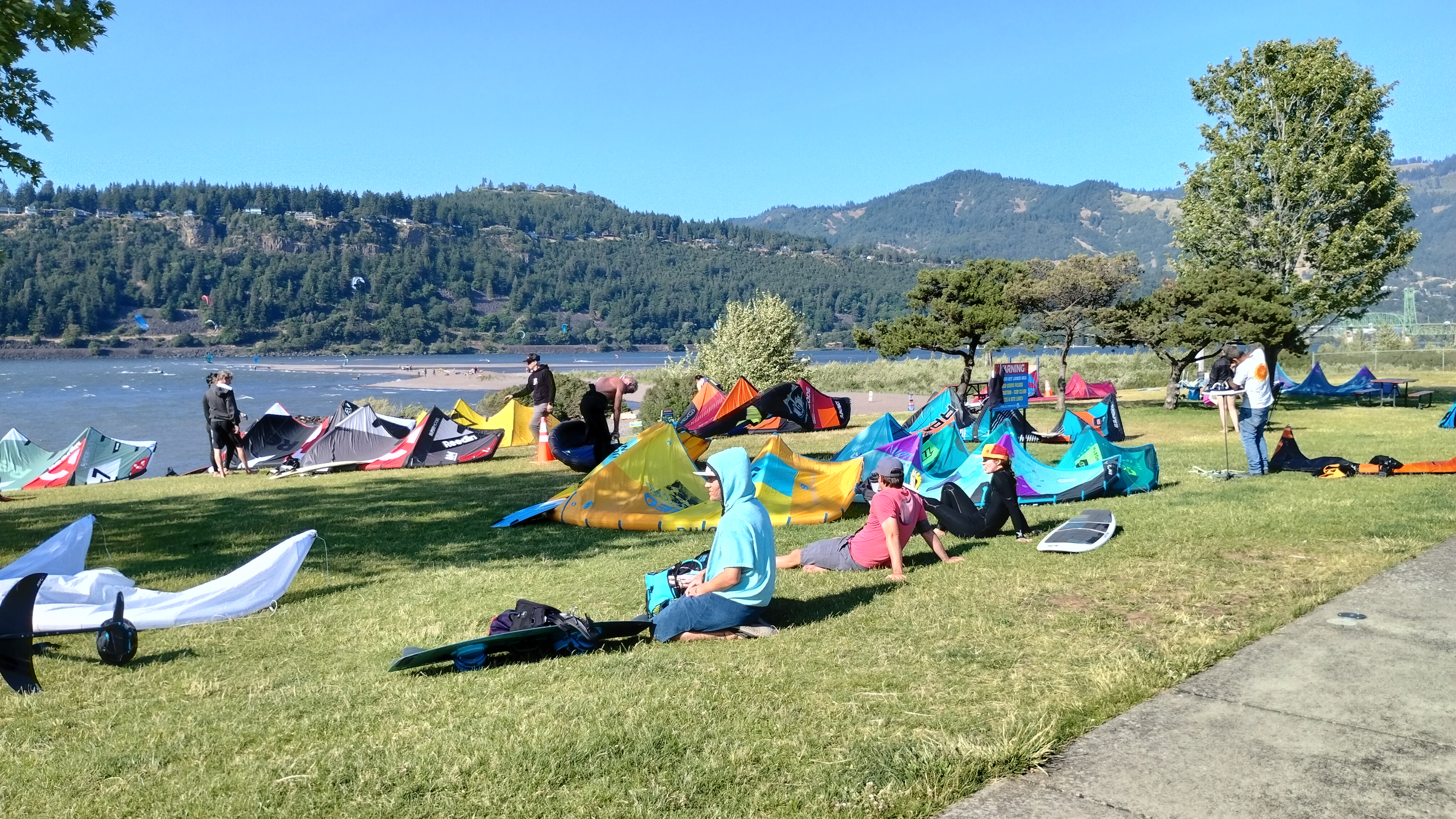
These are hand-kites, a cross between windsurfing and kiteboarding with generally less neck-breaking all around.
The last time I saw this many kiteboarders and windsurfers was two months ago in Pamlico Sound, near Cape Hatteras. I had struck up a conversation with a lady with Washington license plates, and asked if there was any good kiteboarding on the west coast. She said Hood River was spectacular for it, and I’m glad to see firsthand that she was telling the truth 🙂
Stay well everyone,
Evan 💙
P.S.:
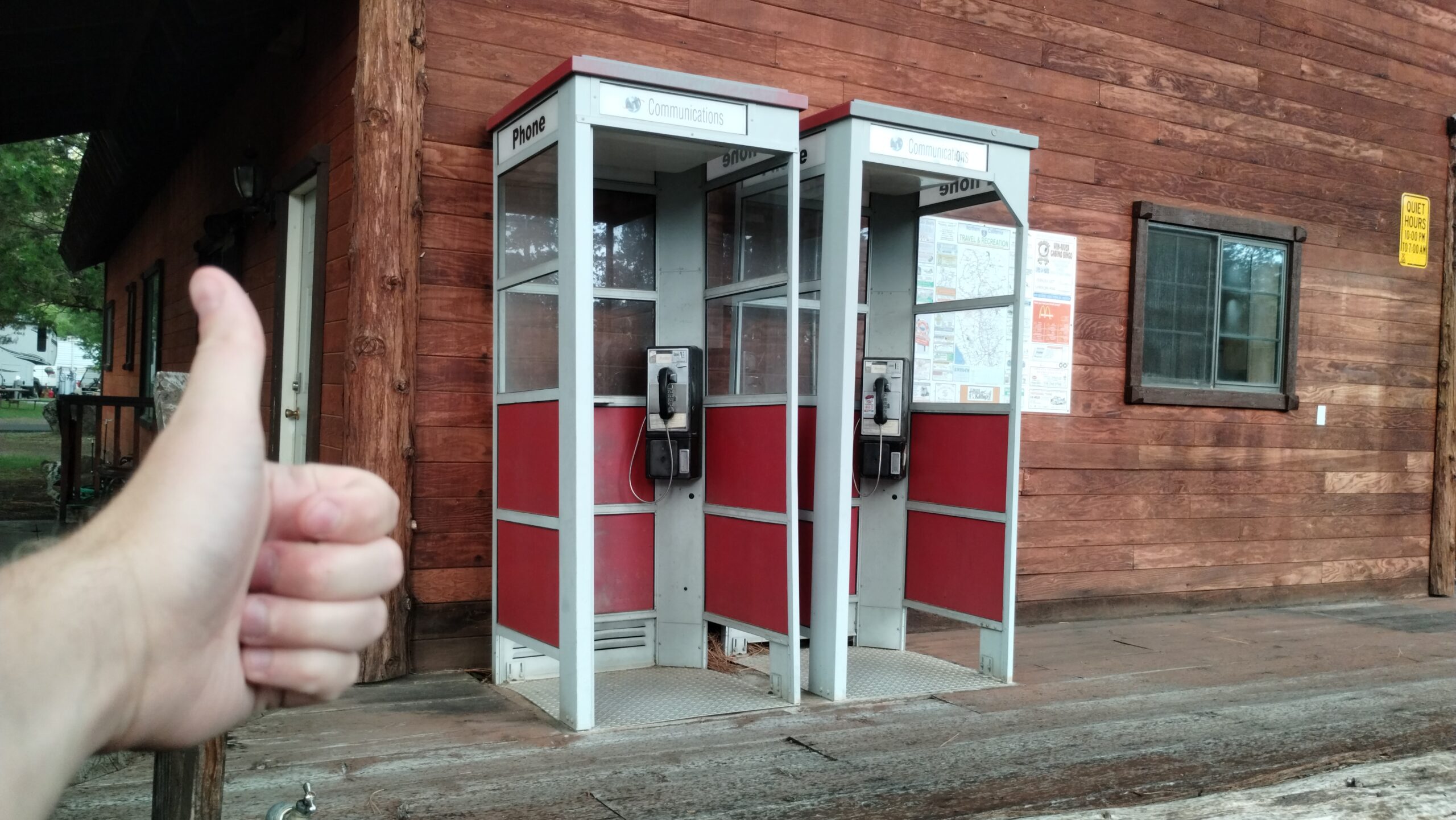
I found a mating pair of working payphones near Lassen! But sadly, you can only use them freely for local calls; you need a phone card for long-distance, whatever that is.